¶ Overview
When a device enters an area affected by electronic warfare equipment (EW), the stronger EW signal can jam the satellite signal and spoof the navigation data. As a rule, the device considers this data valid.
On the track the fact that the device is under EW interference appears graphically as anomalous spikes, circles, jumps from point to point. In raw data: incorrect time, anomalous altitude, rapid movement.
Example of a Track Under EW Interference
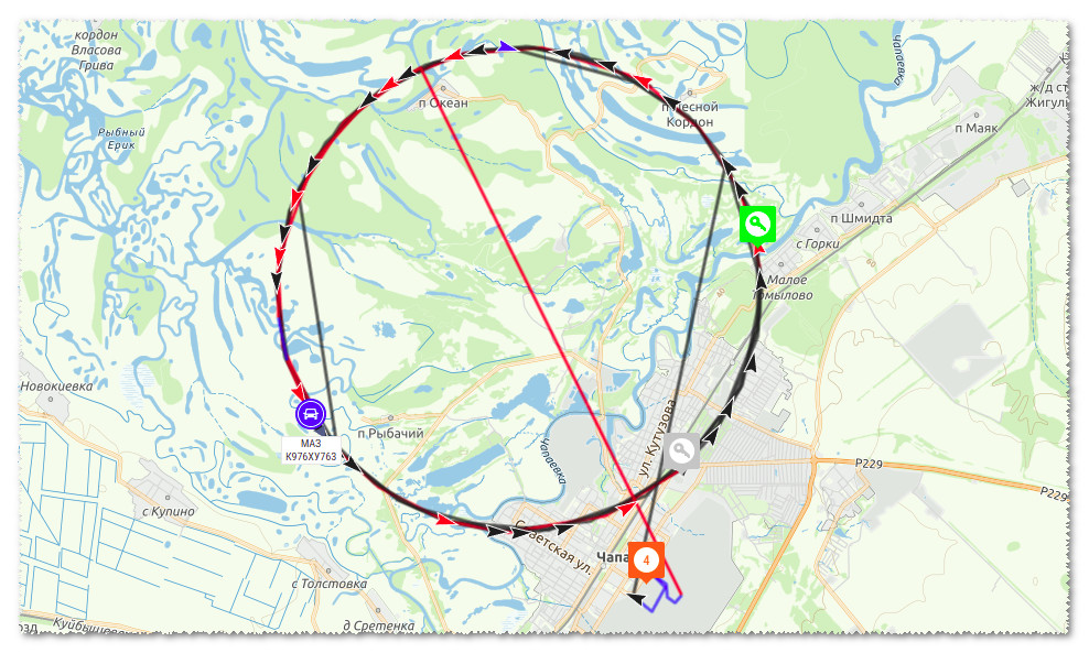
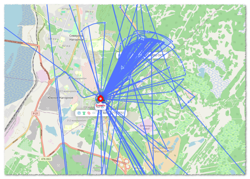
For partial filtering of clearly false coordinates the device settings include the Coordinate Processing functionality.
The Coordinate Processing section settings allow you to specify the minimum and maximum permissible altitude above sea level, speed, acceleration; permissible difference between GNSS and NTP time.
All coordinates, that do not meet these criteria, will be considered invalid by the device.
¶ Configuration
¶ 1. Checking the Device Firmware
The latest firmware version, supporting the full set of settings presented in the Configurator, must be used.
-
To request the version use the command:
*?V(how to send a command?) -
If necessary update the device firmware: firmware list
¶ 2. Editing the Settings
The limits of the available filters should be selected based on the characteristics of the vehicle and the region, in which it is operated.
The minimum and maximum altitude can vary greatly in different cities, therefore there are no recommended settings.
Pay close attention to configuring the altitude range, N.B. incorrect values may cause a large number of valid coordinates to be rejected
To precisely configure the filtering it is recommended to analyze the values at the moment of coordinate spoofing\jamming and set them in the filtering Configuration based on the analysis.
¶ Example
Below is an example of settings, suitable for most trucks and passenger vehicles, that travel near Moscow and the Moscow Region.
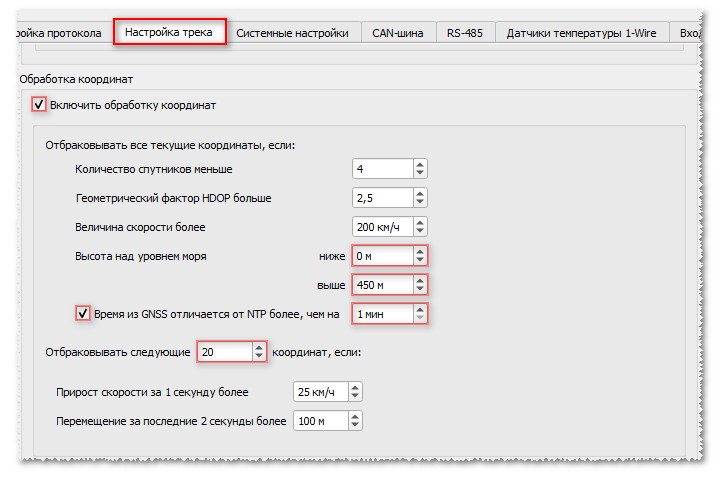
*!EDITS TRACK:COORDFLT(1,,,,,,20,450,0,1)
The settings, applied by the command are described at the following link:
¶ Additional Information
¶ NTP Configuration
For the NTP time filter to work correctly the recommendations in the corresponding article should be followed: