¶ Overview
This article will help configure a NAVTELECOM device to work with the FT Locator function.
FT Locator - is a Fort Monitor monitoring service function, which uses "raw" alternative navigation data to calculate the approximate device location when data from the navigation module is unavailable.
The solution works as follows:
- The NAVTELECOM device collects and stores "raw" data about nearby cell towers and WiFi access points
- The collected data is sent to Fort Monitor
- The FT Locator function converts the "raw" data into geographical coordinates, if the device navigation module data is unreliable
¶ Device
¶ Preparation
¶ Settings
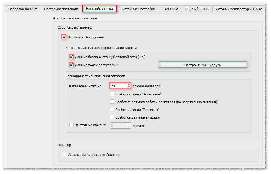
Various combinations of data sources are available for alternative navigation.
The source selection depends on the device capabilities:
| LBS | Any device with a data collection function is suitable |
| WiFi | A device with a data collection function and WiFi module is required |
Each source has its own advantages and disadvantages. All of them affect positioning accuracy and the number of false readings.
| Source | Accuracy | Availability | Mobility | Overview |
|---|---|---|---|---|
| LBS | Low | High | Low | Cell tower data |
| WiFi | High | Low | High | Data about nearby WiFi access points |
| LBS+WiFi | Medium* | High | Medium* | Combined mode, using WiFi and LBS |
Here are some explanations of the source evaluation criteria:
- Accuracy describes the positioning error when using the source
- Availability indicates how widespread the source is (for example, WiFi is available only in cities, and its density depends on the district and city size, while LBS is available wherever a cellular phone works)
- Mobility indicates the likelihood of coordinate errors relative to the source (for example, cell towers do not usually move, while WiFi access points can be either stationary or temporary access points on mobile devices)
Explanation for the "Medium" rating:
➜ for Accuracy this means lower accuracy if there is no WiFi nearby and higher accuracy if WiFi is available nearby;
➜ for Mobility the result will be slightly more prone to errors when there are no LBS towers nearby.
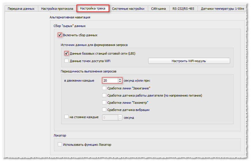
Do not forget to connect the WiFi-module SIGMA to the device.
The module does not require Configuration, it only needs to be connected according to the diagram, shown below.Connection Diagram
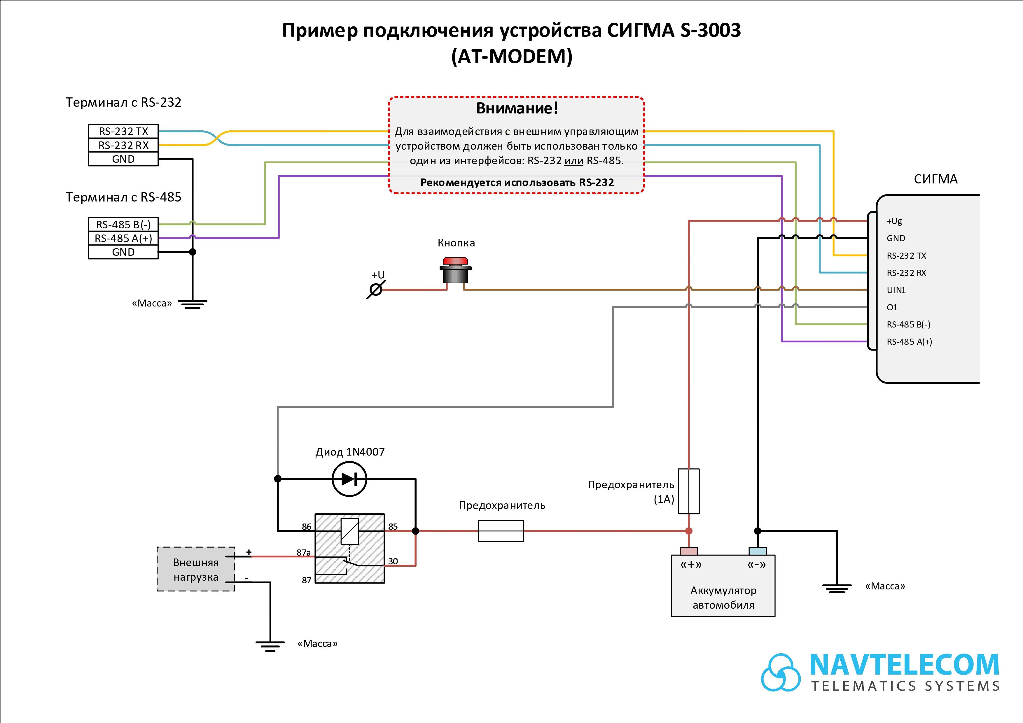
- "Track Settings" Tab
- "RS-232/RS-485" Tab
Configuration of the WiFi-module SIGMA
Configure the interface, to which the WiFi module is physically connected
 |
| RS-232 Interface Configuration Example |
¶ SMS/Internet Command
*!EDITS RS232:OPTIONS(SG01,!,115200,0,1),LOCATOR:TLM(1,11,20,0,0000)
*!EDITS RS485:OPTIONS(SG01,!,115200,0,1),LOCATOR:TLM(1,11,20,0,0000)
¶ Additional Settings
The recommendations, provided in this section are not required for the device to work with the FT Locator service.
However they will help better control coordinate validity and increase the device resistance to EW interference
¶ Fort Monitor
¶ Adding Sensors
In the account on the Fort Monitor server sensors must be added in the NAVTELECOM terminal settings
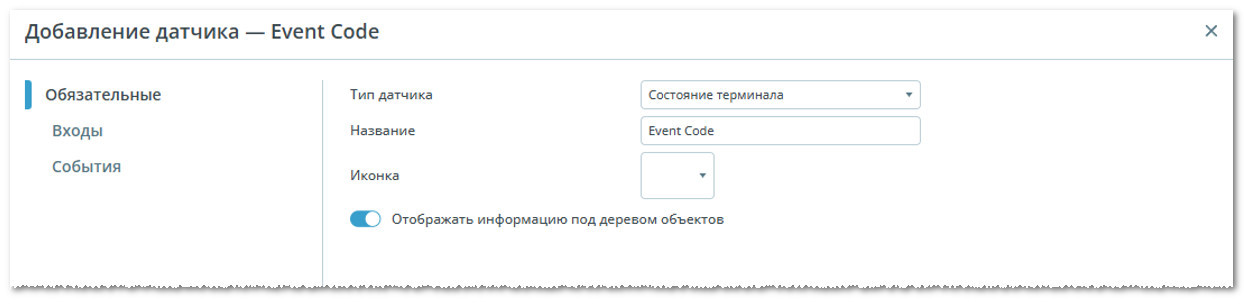
¶ Event Code
Sensor type: Terminal Status
Data source: Terminal Status (Event Code)
Show Interface Example

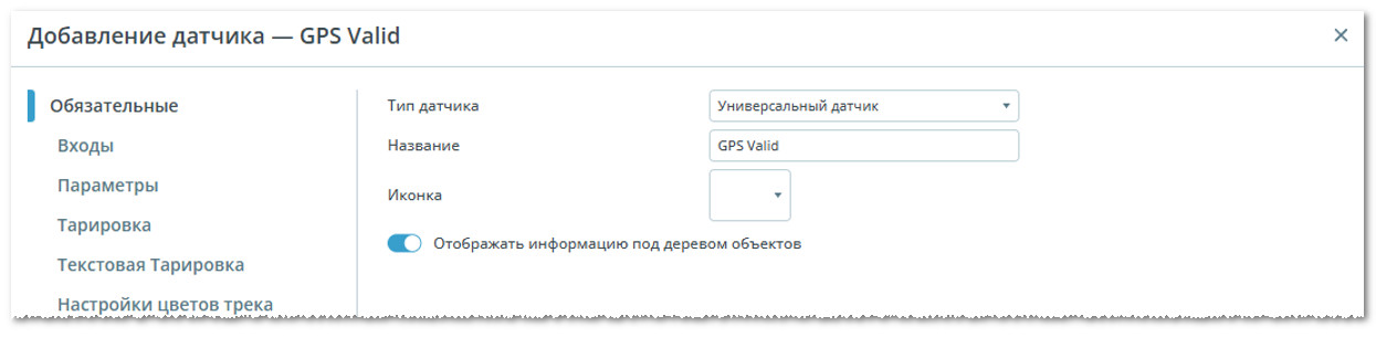
¶ GPS Valid
Sensor type: Universal Sensor
Data source: Sensor Text Name
Sensor text name: di131
Show Interface Example

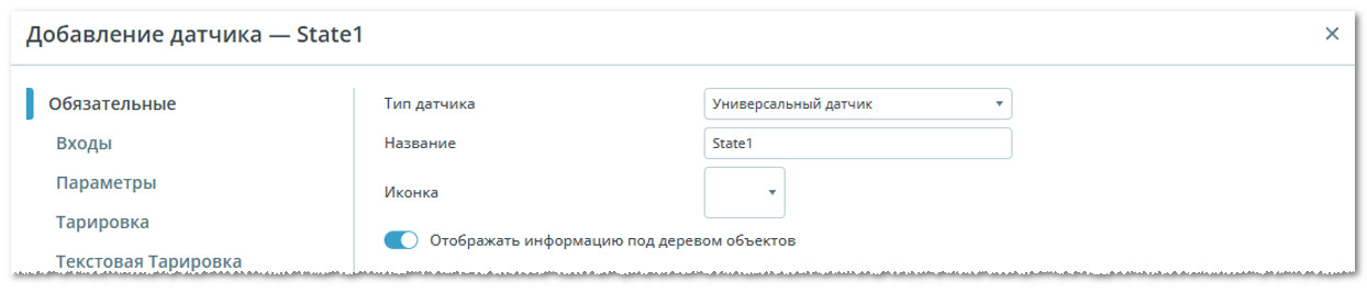
¶ State1
Sensor type: Universal Sensor
Data source: Sensor Text Name
Sensor text name: state1
Show Interface Example

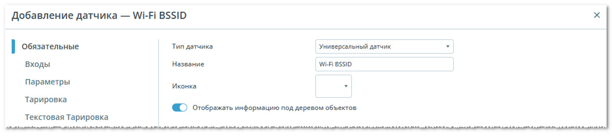
¶ WiFi BSSID
Sensor type: Universal Sensor
Data source: Sensor Text Name
Sensor text name: wifi_spots1
Show Interface Example

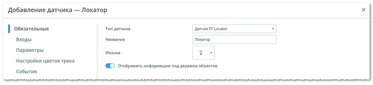
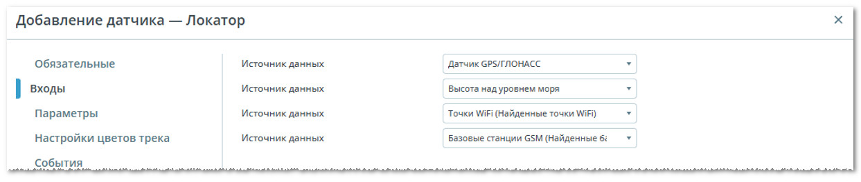
¶ Locator
Sensor type: FT Locator Sensor
Data source: GPS/GLONASS Sensor, Altitude Above Sea Level,
WiFi Points (Found WiFi Points), GSM Base Stations (Found GSM Base Stations)
Show Interface Example
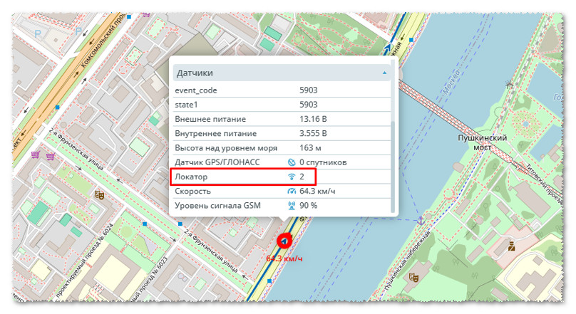
In the "Parameters" section use of the Yandex Locator service can be enabled. This setting will help build the track immediately, without waiting for the FT Locator database to be populated in your region. The accuracy of the provided data is not guaranteed.
Show Interface Example

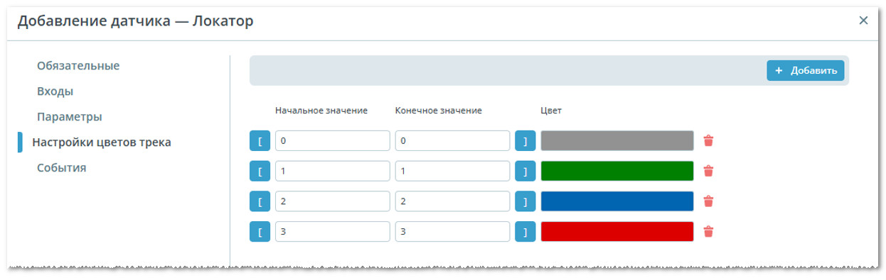
Configure track colors in the FT Locator sensor
| FT Locator | Color | Overview |
|---|---|---|
| 0 | Gray | Coordinates determined via GPS |
| 1 | Green | Coordinates determined via FT Locator, WiFi |
| 2 | Blue | Coordinates determined via Yandex |
| 3 | Red | Coordinates determined via FT Locator, GSM |
Show Interface Example
¶ Operation Analysis
In the Fort Monitor system the track and FT Locator sensor values are used for analysis.
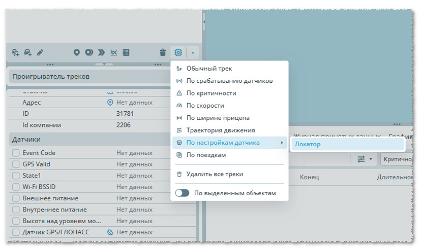
Next build the track not in the standard way, but select "By Sensor Settings" in the track menu and select the required sensor - "Locator".
Show Interface Example
Description of the FT Locator sensor values
| FT Locator | Overview |
|---|---|
| 0 | Coordinates determined via GPS |
| 1 | Coordinates determined via FT Locator, WiFi |
| 2 | Coordinates determined via Yandex |
| 3 | Coordinates determined via FT Locator, GSM |
| 49 | Coordinates determined via FT Locator, source unknown |
| 50 | Coordinates determined via FT Locator, invalid based on maximum speed |